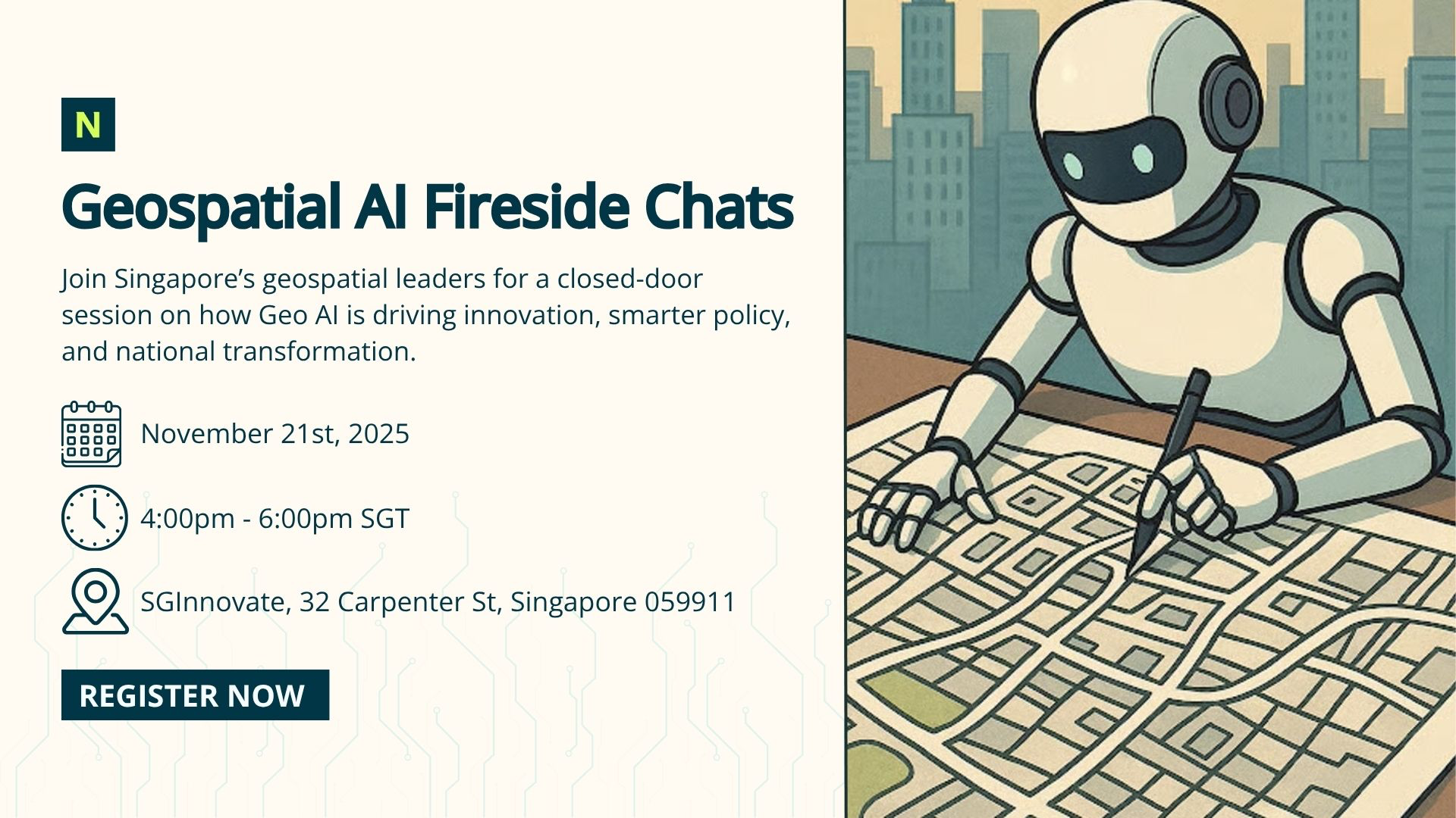
Overview
The intersection of geospatial technologies and artificial intelligence is reshaping how governments, industries, and research institutions understand and manage our physical world — from space-based observation to urban systems and strategic planning.
This closed-door session brings together decision makers and GIS professionals from across Singapore’s geospatial ecosystem for a candid discussion on how Geo AI is driving innovation, enabling better policy decisions, and supporting national priorities.
An opportunity to connect with peers and experts from government, academia, and industry, and to exchange perspectives on advancing Singapore’s capabilities in Geospatial AI.
Programme
4:00 PM - Guest Arrival and Introductions
4:15 PM – Fireside Chat 1, Geo AI in Action: Real-World Deployments and Lessons Learned (30 mins) featuring:
Kenneth Pan, Pix4D APAC
Sapan Kumar, AWS, Head of Smart Cities
Moderated by Jon Wah, Nika
4:45 PM – Fireside Chat 2, The Future of Geo AI: From Space to Urban (30 mins) featuring:
Roy Lin, Head of City Science Lab (collaboration between MIT & Taipei Tech)
Michael Higgins, NTU Satellite Research Centre
Laurent Herviou, Head of AI APAC, Oracle Cloud Infrastructure
Moderated by Jon Wah, Nika
The conversation will explore practical applications of Geo AI across domains — from satellite data and smart city analytics to strategic planning and policy formulation.
5:15 PM – Networking Refreshments (30 mins)
Schedule
Date: 21 Nov 2025, Friday
Time: 4:00 PM - 6:00 PM (GMT +8:00) Kuala Lumpur, Singapore
Location: 32 Carpenter Street, 059911
Speakers
Speaker's Profile:
Laurent Herviou, Senior Director AI-GenAI & HPC, JAPAC, Oracle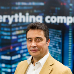
Laurent Herviou is a senior IT executive with over 20 years of international experience driving innovation and managing complex technology teams across APAC, EMEA, and Latin America. As Senior Director for AI–GenAI and High-Performance Computing (HPC) at Oracle, he supports enterprises, startups, government labs, and research institutions in harnessing the power of Generative AI and advanced computing through Oracle Cloud Infrastructure (OCI). With a career spanning industries such as government, oil & gas, life sciences, and defence, Laurent is recognised as a strategic leader and mentor passionate about leveraging AI and cloud technologies to accelerate digital transformation and business growth.
Moderator's Profile:
Johann Wah, President, Co-Founder, Nika
As Co-Founder of Nika, an AI climate-tech startup, I co-lead our mission to deliver revolutionary spatial solutions that scale effortlessly and leverage automation. We believe modern spatial tools are essential to enable a systems-level approach for tackling today’s most pressing climate and societal challenges. Our flagship platform, NikaPlanet, a browser-based AI spatial analysis tool, is just the beginning of how we empower smarter, faster, and more impactful decisions.
Speaker's Profile:
Roy Lin, Head of Urban Informatics , City Science Lab
Roy Yu-Ta Lin is an architect, urban designer, strategist, and data analyst redefining how cities think, design, and evolve through data and AI. As Head of Urban Informatics at the City Science Lab @ Taipei Tech—a joint initiative with the MIT Media Lab—Roy leads cutting-edge projects in urban analytics, spatiotemporal data systems, and AI-driven city simulations. A Harvard GSD graduate, Roy has shaped projects globally with AECOM, OMA, frog, and WeWork. He also founded IVC InVisibleCities and CVI Civic Intelligence, driving innovation at the intersection of civic technology, design, and urban intelligence to create more responsive and human-centered cities.
Speaker's Profile:
Kenneth Pan, Director Of Business Development, Easepect
Kenneth Pan is the Director of Business Development at Easepect, a leader in drone-enabled business solutions. With over a decade of experience driving growth and partnerships, he helps organisations across industries leverage drone technologies and Pix4D’s photogrammetry software to digitize reality, simplify operations, and improve efficiency. Kenneth specialises in turning innovative aerial data into practical solutions, enabling companies to measure, analyse, and scale their operations while unlocking the full potential of imagery technology.
Speaker's Profile:
Sapan Kumar, ASEAN GTM/ BD Leader, Public Sector, Amazon Web Services
Sapan Kumar is a seasoned sales and business development leader with over 20 years of experience driving growth across diverse organizations. As Regional GTM/BD Leader for ASEAN Public Sector at AWS, he helps governments and institutions adopt cloud solutions aligned with national priorities. Sapan specialises in go-to-market strategy, partner engagement, and designing impactful value propositions that deliver real business outcomes. Known for building trusted relationships with C-level executives, he is also a frequent speaker at industry events, sharing insights on technology adoption, data-driven innovation, and public sector transformation.
Speaker's Profile:
Michael Higgins, Sr. Research Engineer, Nanyang Technological University Singapore
Michael Higgins is a Senior Research Engineer at Nanyang Technological University (NTU), Singapore, specialising in space systems and applied research. He holds a M.Eng. in Space Systems Engineering from the University of Michigan and a B.S. in Mechanical Engineering from Oregon State University. Michael’s work spans advanced satellite technologies, space system design, and research-driven innovation. He brings technical expertise and practical insights into aerospace and geospatial applications, contributing to projects that bridge academic research with real-world deployments.